


Hamilton township voting district 14, Mercer County, New Jersey
About
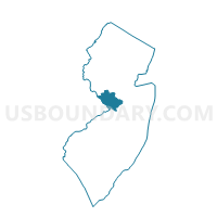
Outline

Summary
| Unique Area Identifier | 619662 |
| Name | Hamilton township voting district 14 |
| County | Mercer County |
| State | New Jersey |
| Area (square miles) | 3.06 |
| Land Area (square miles) | 2.49 |
| Water Area (square miles) | 0.58 |
| % of Land Area | 81.19 |
| % of Water Area | 18.81 |
| Latitude of the Internal Point | 40.16441230 |
| Longtitude of the Internal Point | -74.71855770 |
Maps

Graphs
Select a template below for downloading or customizing gragh for Hamilton township voting district 14, Mercer County, New Jersey


Neighbors
Neighoring Voting District (by Name) Neighboring Voting District on the Map
- Bordentown city ward 3 voting district 1, Burlington County, NJ
- Bordentown township voting district 1, Burlington County, NJ
- Bordentown township voting district 2, Burlington County, NJ
- Bordentown township voting district 3, Burlington County, NJ
- FALLS TWP WD 01 DIST 07, Bucks County, PA
- Hamilton township voting district 11, Mercer County, NJ
- Hamilton township voting district 24, Mercer County, NJ
- Hamilton township voting district 37, Mercer County, NJ
- Hamilton township voting district 49, Mercer County, NJ
- Hamilton township voting district 65, Mercer County, NJ
- Trenton city ward S voting district 9, Mercer County, NJ
Top 10 Neighboring County Subdivision (by Population) Neighboring County Subdivision on the Map
- Hamilton township, Mercer County, NJ (88,464)
- Trenton city, Mercer County, NJ (84,913)
- Falls township, Bucks County, PA (34,300)
- Bordentown township, Burlington County, NJ (11,367)
- Bordentown city, Burlington County, NJ (3,924)
Top 10 Neighboring Place (by Population) Neighboring Place on the Map
- Trenton city, NJ (84,913)
- White Horse CDP, NJ (9,494)
- Yardville CDP, NJ (7,186)
- Bordentown city, NJ (3,924)
Top 10 Neighboring Unified School District (by Population) Neighboring Unified School District on the Map
- Hamilton Township School District, NJ (88,464)
- Trenton City School District, NJ (84,913)
- Pennsbury School District, PA (71,165)
- Bordentown Regional School District, NJ (15,831)
Top 10 Neighboring State Legislative District Lower Chamber (by Population) Neighboring State Legislative District Lower Chamber on the Map
- General Assembly District 30, NJ (270,300)
- General Assembly District 14, NJ (230,937)
- General Assembly District 15, NJ (204,558)
- State House District 140, PA (58,109)
Top 10 Neighboring State Legislative District Upper Chamber (by Population) Neighboring State Legislative District Upper Chamber on the Map
- State Senate District 30, NJ (270,300)
- State Senate District 10, PA (259,178)
- State Senate District 14, NJ (230,937)
- State Senate District 15, NJ (204,558)
Top 10 Neighboring 111th Congressional District (by Population) Neighboring 111th Congressional District on the Map
- Congressional District 4, NJ (724,596)
- Congressional District 12, NJ (701,881)
- Congressional District 8, PA (672,685)
Top 10 Neighboring Census Tract (by Population) Neighboring Census Tract on the Map
- Census Tract 7042, Burlington County, NJ (8,183)
- Census Tract 25, Mercer County, NJ (6,983)
- Census Tract 30.03, Mercer County, NJ (6,293)
- Census Tract 30.04, Mercer County, NJ (5,757)
- Census Tract 26.02, Mercer County, NJ (4,039)
- Census Tract 7017, Burlington County, NJ (3,924)
- Census Tract 7015.02, Burlington County, NJ (3,724)
- Census Tract 1, Mercer County, NJ (2,788)
- Census Tract 9800, Bucks County, PA (0)